

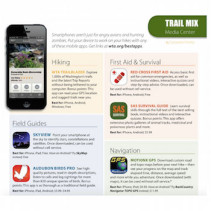
Best Outdoor Apps for 2015
Written for Washington Trails magazine
Visit the published magazine article here and the companion blog here
Smartphones aren’t just for angry avians and hunting zombies. Put your device to work on your hikes with any of these mobile apps. Get links at wta.org/bestapps.
Hiking
WTA Trailblazer: Explore 1,000s of Washington’s trails and the latest Trip Reports without being tethered to your computer. Bonus points: This app can read your GPS location and suggest trails near you.
- Best for: iPhone, Android, Windows; Free
Field Guides
Skyview: Point your smartphone at the sky to identify stars, constellations and satellites. Once downloaded, can be used without cell service.
- Best for: iPhone, iPad; Free. Have an Android? Try SkyMap instead; Free
Audubon Birds Pro: See high- quality pictures, read in-depth descriptions, listen to calls and log sightings for more than 820 unique species of birds. Bonus points: This app is as thorough as a traditional field guide.
- Best for: iPhone, iPad, Android; $3.99–$4.99
WA Wildflowers: Browse plants or search by characteristics for more than 870 common shrubs, wildflowers and vines found in Washington. Once downloaded, can be used without cell service.
- Best for: iPhone, Android, Kindle Fire; $7.99
First Aid & Survival
Red Cross First Aid: Access basic first aid for common emergencies, as well as instructional videos, interactive quizzes and step-by-step advice. Once downloaded, can
be used without cell service.
- Best for: iPhone, Android; Free
SAS Survival Guide: Learn survival skills through the full text of the best-selling book, instructional videos and interactive quizzes. Bonus points: This app offers extensive photo galleries of animal tracks, medicinal and poisonous plants and more.
- Best for: iPhone, Android; $5.99
Navigation
MotionX GPS: Download custom road and topo maps before your next hike—then see your progress on the map and track elapsed time, distance, average speed and more while you adventure. Once downloaded (with maps), it can be used without cell service.
- Best for: iPhone, iPad; $0.99. Have an Android? Try BackCountry Navigator TOPO GPS instead; $11.99
Peakfinder: Point your smartphone at a mountain landscape and instantly find out the names of the peaks you’re looking at. Once downloaded, can be used without cell service. Select from Western U.S., Eastern U.S. and Canada.
- Best for: iPhone, Android; $3.99
Other Notable Selections
- Halfmile’s PCT: Mileage counter and GPS locator for PCT hikers. (iPhone, Android)
- Pocket Ranger: Maps and guides to all of Washington’s state parks. (iPhone, Android)
- Chimani Nat’l Parks: Guide to 401 U.S. national parks, sites and monuments. (iPhone, Android)
- Geocaching: Searchable database of geocaches around the world. (iPhone, Android)
Want to read the blog version of the article and access the links? Check it out here.